Did you know that a single drone can scout a 100-acre farm in less than 20 minutes, a task that would take a human scout several days of intense physical labor? For decades, monitoring large-scale farm productivity meant walking row by row, looking for signs of stress, pests, or dehydration. By the time a human eye noticed a problem in the middle of a massive field, it was often too late to save the crop. The sheer scale of modern agriculture has outpaced our physical ability to monitor it effectively.
The challenge is “Visibility.” How do you spot a nutrient deficiency in a sea of green corn or detect a pest outbreak before it spreads? The solution is literally hovering above us. Agricultural Drones, or Unmanned Aerial Vehicles (UAVs), are transforming the way we “see” our land. They provide a bird’s-eye view that combines high-resolution imagery with advanced data analytics to map productivity with centimeter-level precision. This article will explore how drones are revolutionizing farm management, the incredible benefits they offer, and how you can take your farming business to the skies.
💡 Understanding Drone Mapping: Key Concepts and Importance
To understand Drone Technology in farming, think of it as a flying diagnostic laboratory. These aren’t just toys for photography; they are sophisticated data-collection machines equipped with specialized sensors.
How it works:
- Multispectral Imaging: Drones carry cameras that “see” beyond the human eye. They capture infrared and near-infrared light, which indicates the level of chlorophyll in a plant.
- NDVI Mapping: Using this light data, software creates a Normalized Difference Vegetation Index (NDVI) map. This is essentially a “heat map” of your farm: bright green areas are thriving, while yellow or red spots indicate stress.
- Orthomosaic Maps: The drone takes hundreds of photos and stitches them together into one massive, high-detail map of the entire property.
The Analogy: Imagine you are trying to find a single leaky pipe in a giant skyscraper. You could walk every floor (Traditional Scouting), or you could use a Thermal Scanner from the outside that instantly shows you the exact spot where water is escaping. A drone is that thermal scanner for your farm, identifying “leaks” in productivity before they drain your bank account.
✨ Why It Matters: The Top Benefits of Aerial Mapping
The integration of drones into your workflow offers immediate and measurable advantages for sustainable and profitable farming.
- Rapid Problem Detection: Drones can spot “Stress Zones” caused by pests, fungus, or poor irrigation days or even weeks before they are visible from the ground.
- Precision Input Application: By knowing exactly which parts of the field are struggling, you can apply fertilizers or biopesticides only where they are needed. This is the heart of Precision Agriculture, reducing costs and chemical runoff.
- Accurate Yield Estimation: High-detail maps allow you to count plants and measure their height and canopy cover, giving you a very accurate prediction of your harvest volume.
- Insurance and Documentation: If your farm is hit by a storm or flood, a high-resolution drone map provides undeniable proof of the damage for insurance claims and government aid.
Pro Fact: Farmers using drone mapping have reported a reduction in scouting time by up to 90% and a significant increase in overall yield due to faster intervention.
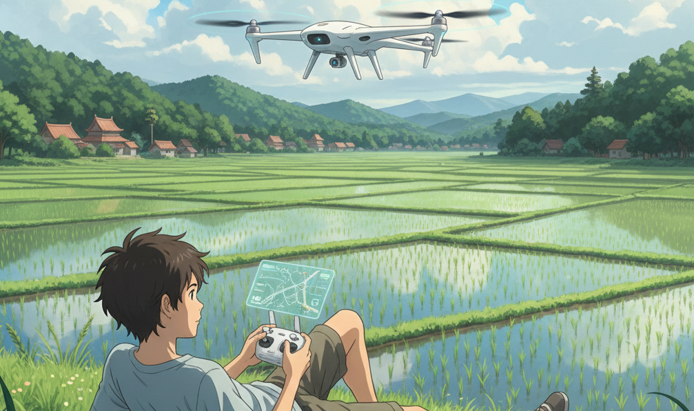
🌱 How to Get Started: A Practical Guide for Beginners
Taking your first step into “Agri-Aviation” is easier than you might think. Follow this 5-step roadmap:
- Step 1: Define Your Goal: Do you just want to see your crops (RGB camera), or do you want to analyze plant health (Multispectral camera)? Beginners should start with a reliable RGB drone to learn the basics of flight and mapping.
- Step 2: Check Local Regulations: Most countries have rules for flying drones. Check if you need a license for “Commercial Agricultural Use” and follow altitude limits.
- Step 3: Choose the Right Software: The drone is just the camera; the “brain” is the software. Look for platforms like DroneDeploy or Pix4Dfields that are specifically designed to turn drone photos into agricultural maps.
- Step 4: Plan Your First Flight: Use “Auto-Pilot” apps. You simply draw a box over your field on a tablet, and the drone automatically flies the grid, takes the photos, and lands itself.
- Step 5: Compare Data with Ground Truth: When your map shows a “Red Zone,” go to that exact spot on the ground. Check the soil and the plants to understand what the drone is seeing. This helps you “calibrate” your eyes to the digital data.
Beginner’s Tip: Don’t buy the most expensive drone on day one. Start with a consumer-grade drone with a good camera to practice “Visual Scouting” before moving to advanced multispectral sensors.
🚀 Overcoming Challenges and Looking into the Future
The biggest hurdles today are the High Initial Investment for specialized sensors and the Technical Skills required to process the data. Additionally, Battery Life limits drones to about 20-30 minutes per flight, which can be challenging for massive plantations.
However, the future is “Autonomous.” We are already seeing “Drone-in-a-Box” solutions where a drone lives in a weather-proof charging station on the farm. It automatically wakes up every morning, flies its route, uploads the data to the cloud, and returns to charge—all without a human ever touching it. Eventually, scout drones will communicate with “Spray Drones” to fix problems the moment they are discovered.
✅ Conclusion
Drones are no longer the future of farming; they are the present. By mapping farm productivity from the sky, we gain a level of control and insight that was previously impossible. This technology allows us to be proactive rather than reactive, saving time, money, and resources while producing more food sustainably. The sky is no longer the limit; it is your new vantage point for success.
Call to Action: Look up a local drone service provider this week and ask for a “Mapping Demo.” Seeing your own farm from above for the first time will change your perspective on agriculture forever.
❓ Frequently Asked Questions (FAQs)
1. Is it hard to fly a farming drone? Not at all! Most modern agricultural drones are fully autonomous. You simply program the path on a tablet, and the drone does all the flying and landing itself.
2. Can drones see pests? While they can’t always see an individual bug, they see the damage the bug causes to the plant’s chlorophyll levels long before a human can.
3. Do drones work in cloudy weather? Yes, but for the best NDVI (Plant Health) data, consistent sunlight is preferred. Advanced software can now correct for minor cloud shadows.
4. What is the best drone for a small farmer? A mid-range consumer drone with a high-quality camera is the best starting point for visual scouting and basic mapping.